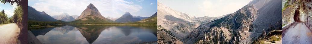
The course of the climb up l'Alpe d'Huez ...
Map:
IGN Serie Bleu #3335 ET, Le
Bourg d'Oisans / l'Alpe d'Huez
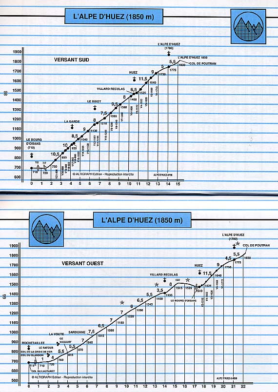
l'Alpe d'Huez Profile:
Atlas des Cols des
Alpes, Volume 3, P. 98
A few informational pointers
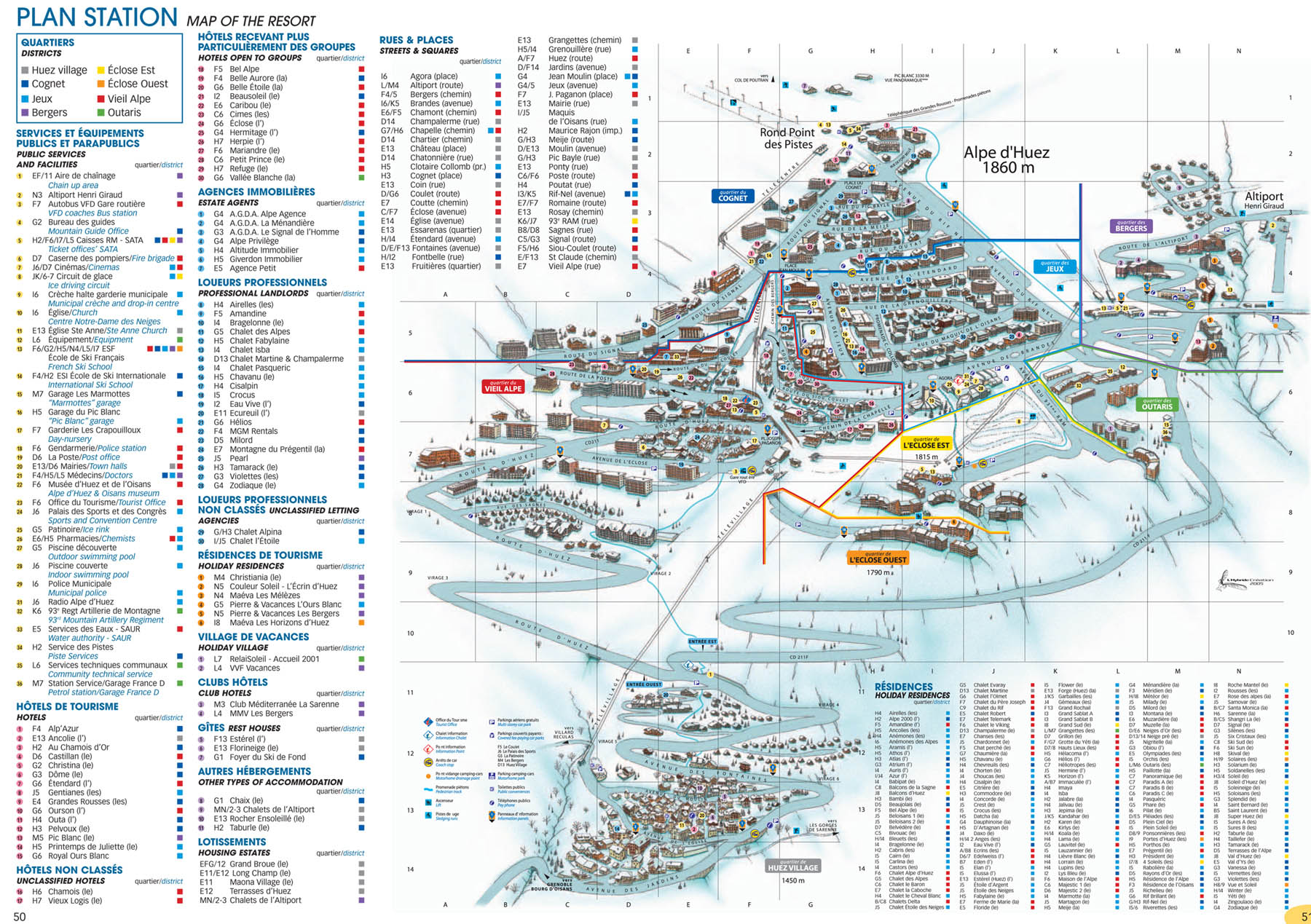
As part of my "research" I watched the ESPN l'Alpe d'Huez finishes repeatedly and carefully and correlated what I could see from the tapes with the detailed map of the village of l'Alpe d'Huez. Stolen from www.alpedhuez.com
Additionally Gerry Soto's switchback-by-switchback account of his ride up l'Alpe d'Huez was also very helpful and entertaining too.
The course
It is my goal here to help the reader who wants to time themselves up the climb to l'Alpe d'Huez and get it right the first time. With this in mind, only information about potential wrong turns is included here. This isn't a switchback-by-switchback account. In the difficulty department suffice it to say that
- It is a medium length climb on the upper end in terms of average percent gradient but not crazy steep like Mt. Washington.
- It starts hard.
- It faces south and is exposed the entire way up so it can get very hot.
- There are no extended easy bits.
The base of the Alpe d'Huez climb starts very shortly out of le Bourg-d'Oisans. Take the N91 east out of le Bourg-d'Oisans until you cross the river and then turn left onto the D211. The first point of interest for the cyclist is the start line for the amateur race, La Montée d l'Alpe. When I rode here in July of 2000 the banner was still up from the race which had happened a few weeks earlier. The start of La Montée d l'Alpe comes almost immediately after taking the turn onto the D211 from the N91. As you make the turn the road goes down a very short hill and La Montée d l'Alpe starts right there at the bottom of the little hill. The first bit of the course after the Montée start is flat. I didn't measure it but it seemed to be slightly less than a kilometer. At the end of this starting flat the climb starts abruptly as the road turns to the left. No chance of any wrong turns yet.
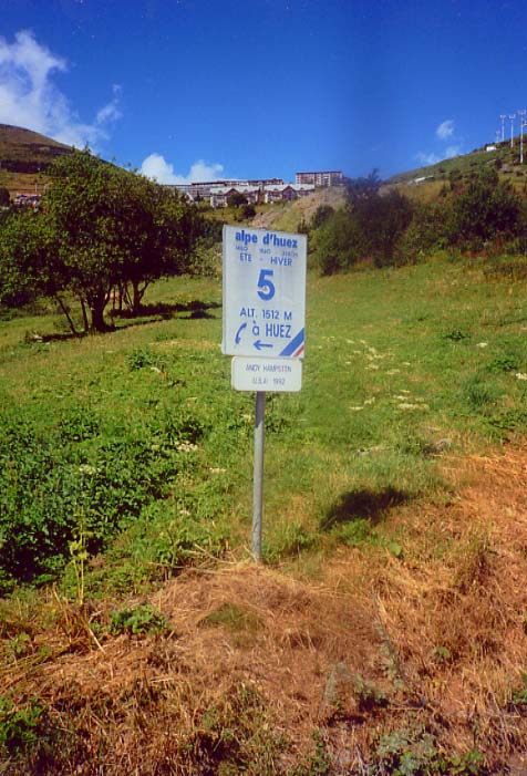
There are 21 switchbacks between the bottom of the climb and the entry to the village of l'Alpe d'Huez. At each switchback there is a plaque bearing the number and the altitude. On a separate, smaller sign appears the name of a previous winner of a Tour de France stage finish at l'Alpe d'Huez and the year that rider won the stage. The switchbacks are numbered in descending order from the bottom up. I.e. The first switchback you come to at the bottom of the climb is #21 and the last one before entering the village is #1. The TdF stage winners and dates are posted from the oldest to the most recent as you climb. Each time the TdF organizers hold a finish in l'Alpe d'Huez they shift the winners' plaques down the hill, bump the one at the bottom and add the most recent winner at the top. I recall seeing Fausto Coppi's name on one of the signs (I think it was #21) and I'm guessing his name is not bumped because he won the first TdF stage to l'Alpe d'Huez in the 1950's.
There are no possibilities for wrong turns as the D211 climbs sharply through the first batch of switchbacks to the village of la Garde then to the small settlement of le Ribot and next to the village of Huez which lies below the higher village of l'Alpe d'Huez.
In the village of Huez after switchback #6 you pass the intersection with D211B which leads off to Villard-Reculas. The road is marked and it's pretty obvious which way to go to stay on the D211 proper towards l'Alpe d'Huez. Shouldn't be a problem. At this intersection there are around 4 & ½ K. to go until the TdF stage finish line.
The dreaded "wrong turn"
The road forks between switchback 4 and 3. The race course takes the left fork which follows the D211 proper. The right fork takes you off onto the D211F and around to the village of l'Alpe d'Huez the back way. This is the dreaded wrong turn. Just remember. After switchback 4 bear left at the fork. Just after the intersection with the D211F you'll see some flags on your right. If you see them on your left you made the wrong turn.
The next point of interest comes after switchback #1. The road rises sharply just after this "last" switchback and then levels off noticeably as you enter the lower section of the village of l'Alpe d'Huez. Very soon after the road eases you pass the Tourist Information Office on the left. La Montée d l'Alpe finishes here and in late July of 2000 the finishing banner was still draped across the road. Maybe they leave it up all year. I dunno. The tourist office is set atop a long flight of steps. Look for the steps and you've found it.
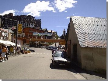
From this point on refer to the detailed map of the village of l'Alpe d'Huez. Stolen from http://www.alpedhuez.com/doc/doc_Pla_S.jpg After passing the tourist office you are located at roughly co-ordinates 7-F on the map. The street is called la Route d'Huez and you're at Place Joseph Paganon. At this point you take the first left after the tourist office and go underneath what seems to be a structure linking buildings over the road. On the map this left is directly above the text "Pl. Joseph Paganon" and is partially obscured by the big "P" for parking. This is sort of a queer turn so keep your eyes peeled. The picture to the left was taken by Gerry Soto and appears to be taken from underneath the Montée de l'Alpe finish banner. Notice how the road forks. You take the left fork which curls around sharply to form an effective switchback. As I remember it you don't actually go under the walkway that you can see in this photo. The left turn goes under a much more ample structure that doesn't seem to be visible in this shot. (BTW. The walkway in this photo shows up as a land bridge in the map pointed to above. Follow the pointer and you'll see what I mean. It is all the same white color as used in the map for snow.)
For the particularly anal person who happens to have a tape of the 1992 ESPN TdF coverage of this stage (which was won by Andy Hampsten) you can get a sense of this turn there. Make note of where Paul Sherwen says, "And Hampsten is on the flat part of the course picking up speed and he's really flying towards an incredible victory.". Just as Sherwen finishes saying this Andy starts the left turn. You'll notice the walkway structure in the picture above just as Hampsten veers off to the left.
The left turn curls around sharply and forms what is effectively another switchback and now you're climbing again up the Route de la Poste. Continue climbing through the village along the Route de la Poste. You now come to yet another switchback - the real last switchback of the climb to the TdF stage finish. This one is located on the map at the approximate co-ordinates of 5-B. Note that the street becomes the Route du Signal after you round the switchback which BTW. is where, in the 1997 Tour Pantani, and soon after him Ulrich, were both going so fast that they had to slow down.
Soon after the last switchback you will see this sight which may appear familiar to you if you, like I, spend long winters sitting on a trainer watching old TdF tapes. It's the chalet building that sits near the 1 Km. to go banner. You may also recognize this view as the place where Giuseppe Guerini was knocked off his bike by the spectator out of bounds on his way to the stage victory in the 1999 TdF.
Keep your eyes peeled now. You take the first right after the 1 Km. remaining chalet (actually its the first right after the last switchback too) onto the Place Jean Moulin. The street is named the Avenue de l'Étendard but I can't recall seeing any signs here. The map makes it appear to be a switchback but as I remember it, it was more of a plain old right turn. In my little note book I jotted down a comment that said, "Turn from Route du Signal onto Pl. Jean Moulin is easy to miss. Glad I reconnoitered yesterday.". So beware.
The stretch along the Avenue de l'Étendard is flat and even dips down in a few places. As this area is mostly shops and restaurants it's likely to be busy except early in the morning. I seem to remember a rotary where l'Avenue de l'Étendard crosses l'Avenue des Jeux even though it isn't indicated on the map. At any rate you stay on l'Avenue de l'Étendard until you come to its end at l'Avenue du Rif Nel (co-ordinates 5-J) and take a left here at another rotary. There is definately a rotary here even though it is not indicated on the map.
KZ Note: 27-Jan-2007 Just updated pointer to Alpe d'Huez village map from alpedhuez.com and the map changed a bit and now indicates the rotaries. Left text above in the event they change the map again.
You're in the finishing straight now. You climb a little more to the finish line (co-ordinates 3-I) at the intersection of l'Avenue du Rif Nel and Rue du Pic Bayle. On the left at the finish line is the Hotel Le Chaix.
Congratulations! You've now climbed to the official Tour de France l'Alpe d'Huez stage finish with no wrong turns and hopefully you, like I , have it out of your system.
I am interested in pictures that anyone would let me put up here of any of the key turns in the village. I shoulda thought to take them. Oh well. I'm thinking of a photo of the La Montée finish, the left turn just past it, the right at Pl. Jean Moulin onto the Avenue de l'Étendard and the finish on the Avenue du Rif Nel. And maybe one of the wrong turn between switchback 4 and 3. Sort of a photo tour of the course finish for those who want to get it right the first time, maybe because their first time is going to be the only time. If you have any such photos (or maybe you might take some for me on your trip) please email me.)
I am also interested in "distance remaining" information about key points of the climb starting at say, 5 K to go to the TdF finish. When I scoped out the course before my own ride I drove the course backwards from the TdF finish line and jotted down the distance remaining at certain landmarks and memorized it. When I rode it the next day this information helped me to progressively ramp up the pace as I drew closer to the finish. Unfortunately the old memory isn't what it used to be and now I can't remember for sure. I had the distance remaining at the La Montée finish which I think was around 1 & ½. And I think 3 K. to go was just before switchback 2, etc.