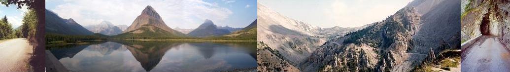
Col d'Agnel et. al.
July 29, 2000
Distance: 49 km.
Climbing: 1410 m.
Map:
Michelin #244, Rhône-Alpes
Col d'Agnel Profile:
Atlas des Cols des
Alpes, Volume 2, P. 34
After a sound sleep I am up and ready to roll at 7:30 AM when the hotel comes to life and the gates to the parking lot are opened. I decide to take breakfast at the hotel since I've been forced to wait this long anyway. After a quick breakfast it's to the car and I'm off.
The plan for today is to drive to Briançon on the N91 and then due south to Guillestre on the valley road (the N94). Then it's northeast up the D902 to Château-Queyras which is conveniently located at the base of the south side of the Col d'Izoard and the west side of the Col d'Agnel. I will then ride the Col d'Agnel and, time permitting, the Col d'Izoard too. After all this it's a drive back down to Guillestre and then up and over the Col de Vars and down to my next stop, the town of Barcelonnette.
In a bit of dilly dallying I decide to take one more quick drive up the D211 towards l'Alpe d'Huez. I wanted to snap a picture of the switchback sign with Beat Breau's name on it for a friend at work named Breau but had thus far forgotten. So it's up the road one last time. On getting to the sign (#14) I find that Beat's surname is Breu, not Breau as is my friend's so the effect is gone. Oh well. I snap the picture anyway and book back down to the N91 to bid adieu to this Mecca of French cycling.
Although the N91 from le Bourg d'Oisans is very busy it does have some nice scenery. It's a pleasant sunny day and the time goes by quickly until the entry into the "metro-Briançon" area.
There is a string of villages along the N91 as you approach Briançon starting around 10 K west of the city with the town of le Monêtier-les-Bains. The closer you get to Briançon the more built up it becomes and the worse the traffic gets, evidently, since there was a lo-o-o-ng backup of bumper-to-bumper traffic trying to get through these towns. I can't remember exactly where the serious tie up started but I'd guess I lost 45 minutes to an hour getting through. I'm kicking myself now for not getting an early start and all the dilly dallying I'd done this morning.
By the time I finally make it to Briançon itself I realize that my plan to try both the Izoard and the Agnel and still make it to Barcellonette in time to find a hotel is no longer feasible so another plan is needed. Being that I rode the Izoard from Briançon in 1992 when I was last here in France but have never ridden the Agnel the Agnel gets the nod. Yet I'd like to see the south side of the Izoard too so I'll drive up and over the Izoard and down to Château-Queyras where I'll stop and ride the Col d'Agnel. Oh well. More compromises.
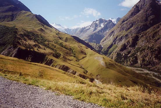
The traffic getting through Briançon is again slow but it finally breaks free on the turn off of the D902 and the climb of the Col d'Izoard. It's still sunny and starting to get warm and the climb is crawling with club cyclists and car and motorcycle traffic all enjoying the beautiful day and scenery. I am embarssed to admit that I was just whizzing along, enjoying the narrow twisting mountain road and the responsive feel of the little Renault and can't remember much of the scenery. I missed writing up my daily notes for this day of the trip and looking back on it now, almost a year after I took the trip, I remember more from 1992 when I rode it rather than last year when I drove it. Just goes to showya. A bike is truly the best way to tour the mountains!
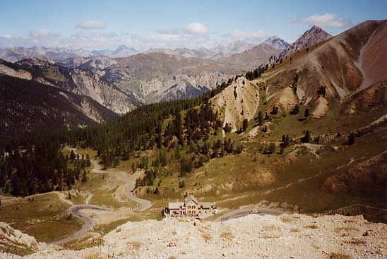
The first chunk of the climb is fairly straight-ish, climbing easily with the mountain to the left and an open river valley to the right. There is a flat spot in there too somewhere. After about 10K you hit the small village of Cervière which has, as best as I can describe it, a sort of terraced waterfall with a series of dams closely placed together. It's after this point that I remember the serious climbing starts. The road becomes narrow and twists in typical apline fashion with frequent tight switchbacks. The lower section is forested and some shade is possible but becomes exposed higher up. The scenery towards the top is quite nice which is why so many folks rate this climb as one of their favorites in the French Alps.

Just after the top a bright American flag painted on the road is evidence of this year's passage of the Tour de France over the col - the racers climbed it from the south side in a stage that also included the Cols d'Allos and du Vars.
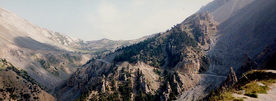
Soon after the descent of the south side of the Izoard begins the road passes through an area known as the Casse Déserte, a landscape of spires of brown rock.
At the bottom of the col it's a left turn onto the D947 towards Château-Queyras, a complex of fortress buildings perched on a pronounced rock just above the river Guil. It's only a few K from the turn off. No parking here to start the ride so I press on and find a pull off a few K's further on.